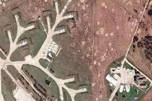
‘Russia-Ukraine war’ - Controversial satellite photo from Google Maps - Here's the explanation!
Home > News Shots > World newsReports that some parts of Russia have been mapped by Google have caused a stir.

The war between Russia and Ukraine has been going on for more than a month. Russian troops have been conducting airstrikes in various parts of Ukraine. Thousands of civilians have been killed. The Ukrainian military is retaliating.
Meanwhile, Russian forces have been accused of using Google Maps to track routes and traffic in Ukraine. Following this, it was reported that Google has suspended its Google Map service in Russia.
It has been reported that Google Map has 'blurred' some parts of Russia due to heavy weapons in Russia. The photos were posted on social media and caused a stir.
Google Map explains this in this context. It said, "Google Map does not cover or blur any part of Russia." Google has put an end to the rumors circulating on social networking sites.
Google Maps has stopped hiding Russia’s secret military & strategic facilities. Allowing anyone in the public to view.
Open sourcing all secret Russian installations: including ICBMs, command posts and more with a resolution of 0.5m per pixel. pic.twitter.com/K77t0gmt3J
- OSINT UK (jon96179496) April 18, 2022
OTHER NEWS SHOTS


